Mgr. Jozef Bogľarský
Department of Smart Land Management

Education: Geoinformatics and Remote Sensing, Faculty of Science, Pavol Jozef Šafárik University in Košice
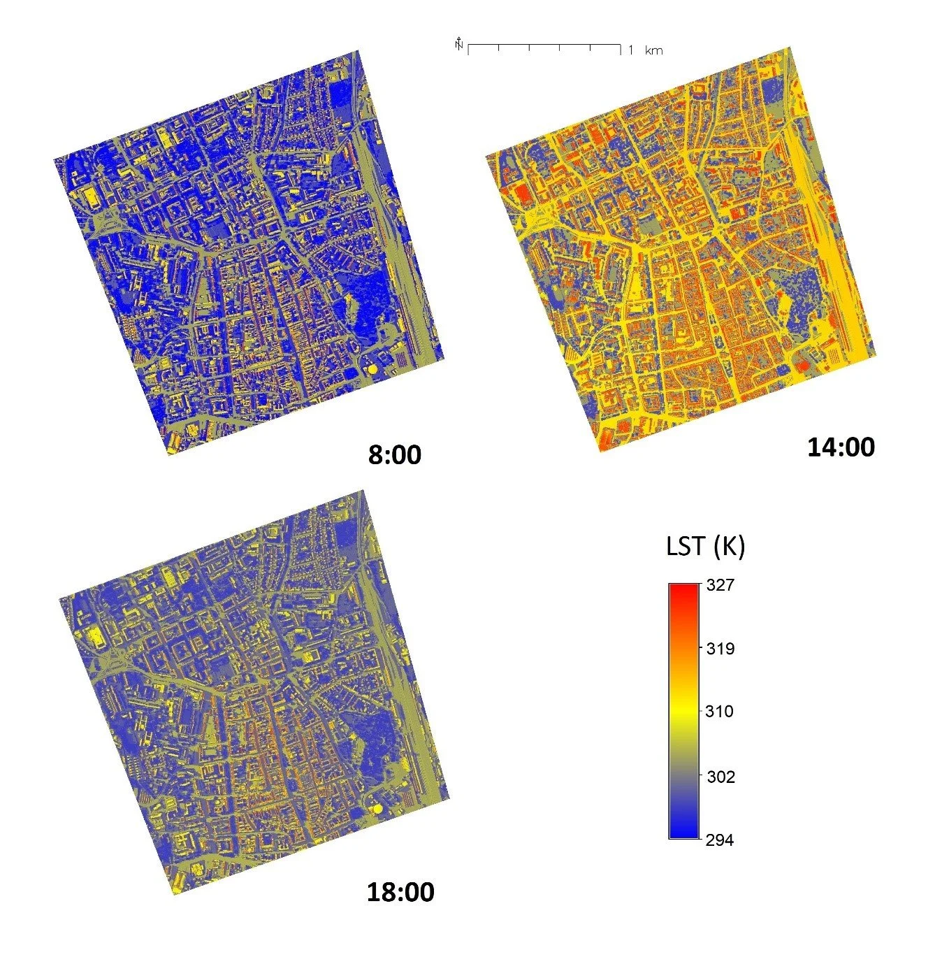
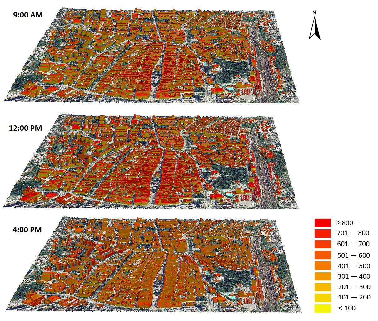
Jozef Bogľarský is an experienced GIS specialist with more than 10 years of experience in geoinformatics and remote sensing. He has extensive experience in data collection and processing, structured geodatabase creation, and spatial data management. He has participated in surveying and mapping using UAVs, focusing on modern GIS passport projects such as traffic signage, cemeteries, local roads, and urban greenery. As part of his doctoral studies at the Institute of Geography at UPJŠ in Košice, he focused on modeling the solar potential and surface temperature of urbanized areas. During his career, he has led or participated in various research projects and taken part in various study stays, during which he deepened and expanded his professional knowledge.
He currently specializes in GIS in spatial planning. As the administrator of GIS systems at the Office of the Chief Architect of the City of Košice, he is responsible for the implementation, administration, and maintenance of GIS tools and data. He is the author of a comprehensive GIS solution to support the creation and digitization of the draft new spatial plan for the city of Košice. His work includes processing map data and information, creating and managing complex geodatabases, demographic and statistical analyses, and providing mapping and geoprocessing services. He coordinates GIS data, creates web mapping applications, prepares press materials, and shares data. He is also responsible for maintaining and updating the digital archive and integrating innovative GIS technologies into the spatial planning process.

Key characteristics:
Ability to manage complex projects and coordinate teamwork
Proactive problem solving and flexible adaptation to new technologies
High level of expertise, strong analytical thinking, and precise work with data
Significant projects and achievements:
Member of the processing team for the draft of the new spatial plan for the city of Košice
Recipient of the VVGS UPJŠ Early Stage Grant and principal investigator of the project - Modeling the dynamics of surface temperature in the city using GIS tools and material temperature measurements
Certificates:
Certificate BIP 'Digital Earth Citizens' z Paris Lodron University of Salzburg
Certificate The RawMatCop Academy RIS - Copernicus Earth Observation Programme
European Certificate of Computer Skills EPP GIS
Certificate EASA of remote pilot competency of theoretical knowledge for A1/A3
Contact:
+421 911 160 155
boglarsky@umbrasolutions.eu
LinkedIn: Jozef Bogľarský